16 November 2018
With the help of ENVI-met, it is possible to determine the microclimate of a city down to the square meter, while effects of construction projects, soil sealing, and green spaces can be exactly predicted. Professor Michael Bruse of the Institute of Geography of Johannes Gutenberg University Mainz (JGU) has been working on this software for 25 years. As time went by, the specialist in geoinformatics incorporated increasingly more factors and made the 3D simulation more complex. ENVI-met is now in use around the world.
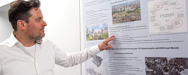
The posters in the hallway leading to his office tell a success story. "This here was one of our earlier investigations," Professor Michael Bruse points out. "At that time we were still restricting ourselves to a small area and the resolution was not really that good." The image shows various streets in Sydney in Australia. Numerous arrows indicate the air flows between the houses. A later project focused on tree plantings in Kiel in northern Germany, where a strong breeze might be enough to bring down the greenery. So where should the city planners plant their trees? A third poster depicts the metropolis of São Paulo. This project focused on the influence of dense building development on the climate and the determination of the city warming effect.
"Since my very second semester of studies, I've been working constantly on the development of this software," says Bruse. "I’m really glad that I've had that luxury." As a student at Ruhr-Universität Bochum, he started looking into how the casting of shadow influences the climate. In 1999, he wrote his graduation thesis on surface temperatures and, four years later, he submitted a first version of his climate modeling concept with his dissertation. In Bochum, Bruse also received his postdoctoral lecturing qualification before being appointed Professor of Geoinformatics at JGU's Institute of Geography in 2007, bringing with him in his luggage his long-term project, the ENVI-met software.
15,000 users, 250 dissertations
The three-dimensional model makes it possible to accurately predict what effects construction projects will have on the climate of a city. "Among other things, we are using it in connection with the Dubai Expo 2020. And it is also employed for the Cooling Singapore project." There in the humid tropical climate, temperatures are around 28 Celsius degree the whole year round so cooling is needed to enhance the living comfort of its inhabitants.
"We can't keep track of all of the projects that work with ENVI-met. We have about 15,000 registered users and some 250 doctoral dissertations have been produced as spin-offs. The software is freely available. That was important to us. And anyone can use it. It runs on a standard computer. So regions where resources are very limited can profit from our climate modeling system. Bangladesh is a good example. Only those who want to use the extended version need to pay for it."
Of course, Bruse and his Environmental Modelling Group (EMG) at the JGU Institute of Geography can't keep an eye on everything that’s going on, but they do have worldwide connections. "Our software is used a lot in Brazil. And we have exchange students coming from there to Mainz. We also have contact with China and a corresponding exchange program. There they are very interested in exploring the possibilities offered by predicting urban climate. Many think that China is just making cheap copies of what we produce, but that is a cliché. They have very high standards and it is fascinating to observe how a construction project for ten million people develops there."
Urban planning and heat stress
But how does ENVI-met actually work? "Obviously, we first need environmental data and straightforward information about buildings from the land registry office, topographical data on the terrain, and information on the existing vegetation, such as trees. We also need to know about materials that were or are going to be used. A particular road might produce more heat than another, light-colored facades reflect heat, dark ones absorb it. We also employ data on air flows. On the basis of all this, it is possible to determine microclimates with remarkable precision." In special cases, even physiological information on city inhabitants is used. Levels of heat stress can be ascertained on the basis of sweat production and blood regulation. "We use many scientific disciplines in our research."
Those studying geography at Mainz University work with the model on small scale but also sometimes large scale projects. "In a typical dissertation, the first year is spent creating a concept, the second year involves taking measurements and collecting data while the data is processed in the third," says Bruse, summarizing the process.
The concept of taking climate into account in urban planning is not a new idea, quite the contrary: "Even in ancient Rome they took microclimatic factors into consideration when building and these also played a major role in the Arabic world. After the Second World War, Copenhagen placed considerable emphasis on creating the right urban microclimate." Urban recreation areas were built that stretched right into the city center. "The Dutch, for example, do a lot using water. Here in Germany, however, we have become less aware of the significance of these aspects. Back in the 1980s, buildings were considered to be self-sufficient structures that just needed to be heated up or cooled down as necessary. Hardly anyone was interested in what was going on around them."
Collective green research
In the meantime, attitudes have changed. All the debate on climate change, environmental protection, the effects of airborne particulate matter, and emissions of all kinds has put the subject of urban climate back in the spotlight. And it now features as an aspect in nearly every larger construction project. "However, no one has specified exactly what the intent is, what form a corresponding assessment should take, or to what extent the findings need to be taken into consideration. We have upper limits for levels of waste gases, but none for temperature."
ENVI-met is more relevant than ever and new aspects are constantly emerging. "Big on the agenda at the moment are green facades and roofs," says Bruse. "There is no space left in our cities any more. So plants are one way of getting rid of excess heat. We are currently working in a collective research project to develop a modular system consisting of plant tiles that can be simply clicked together and mounted on facades." The project is called GreenSkin and is being funded by the European Union like its predecessors proGreenCity and Green4Cities.
There is still a lot of interest in the subject and Bruse and his team will continue to work on upgrading ENVI-met. Indeed, after this year's unusually hot and dry summer, a microclimate modeling concept such as ENVI-met should currently be a star attraction. After all, weather and climate are making headlines. But Bruse is not impressed: "The newspapers may use it to fill their columns when we experience a summer like the last. But it's forgotten as soon as it's over." Even so, he is staying on the ball. He has been tinkering with his software for 25 years. And there's still no end in sight.


